October 15, 2022
6 best hikes in Los Angeles with stunning views
Los Angeles is blessed with sunny weather nearly year-round and a geographical location that allows you to visit some of the best beaches and mountains in the state in the same day. Add to that plenty of hiking trails and you have a pretty good picture of this Golden State.
Below you will find six of many trails in LA area.
1. The Charlie Turner Trail to Mount Hollywood (Griffith Park)
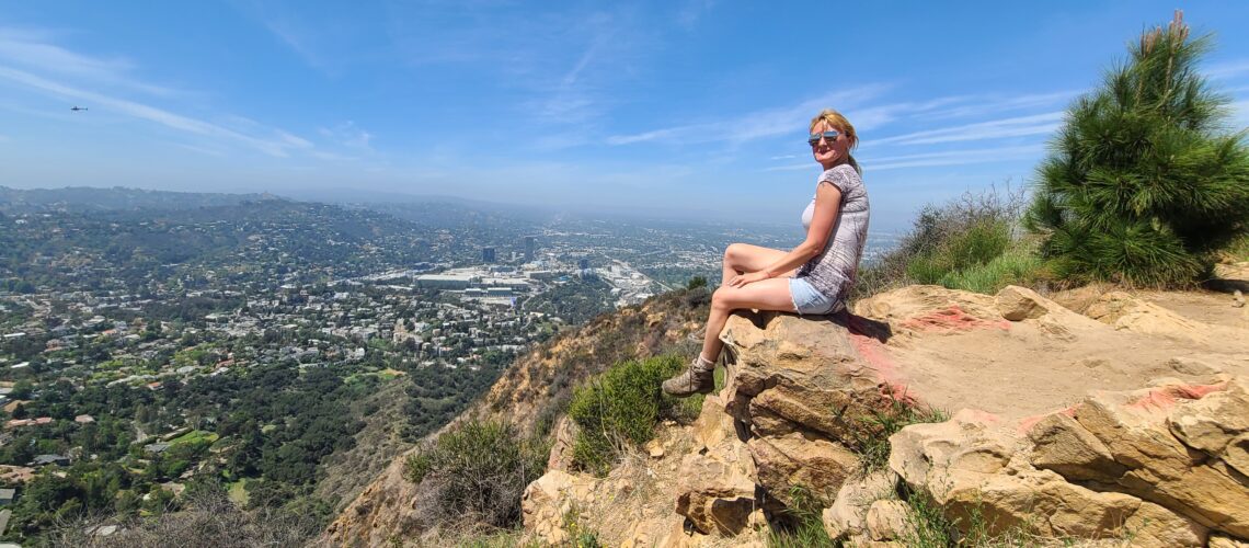
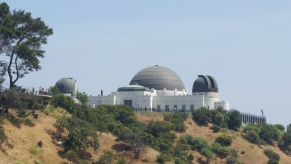
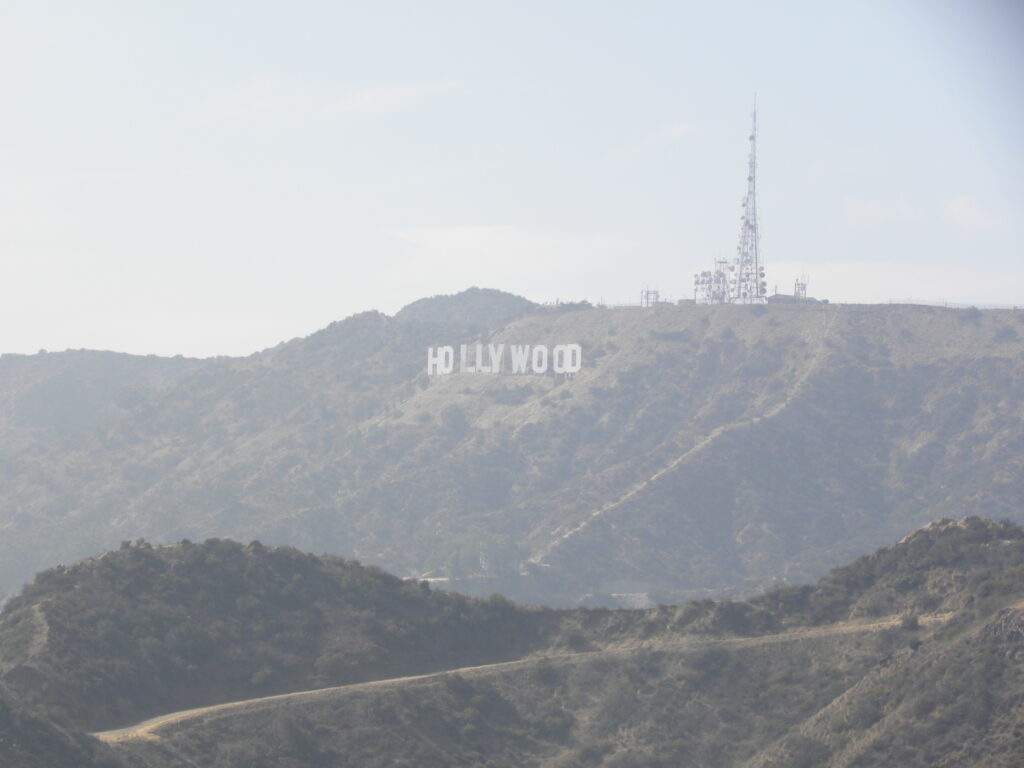
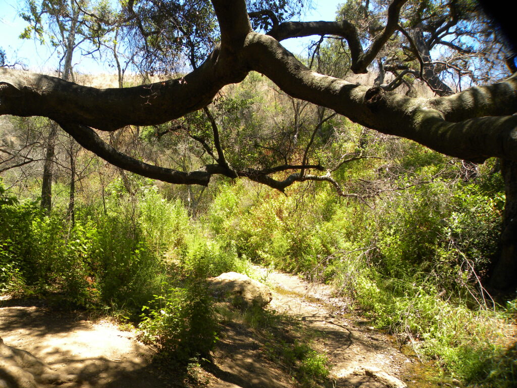
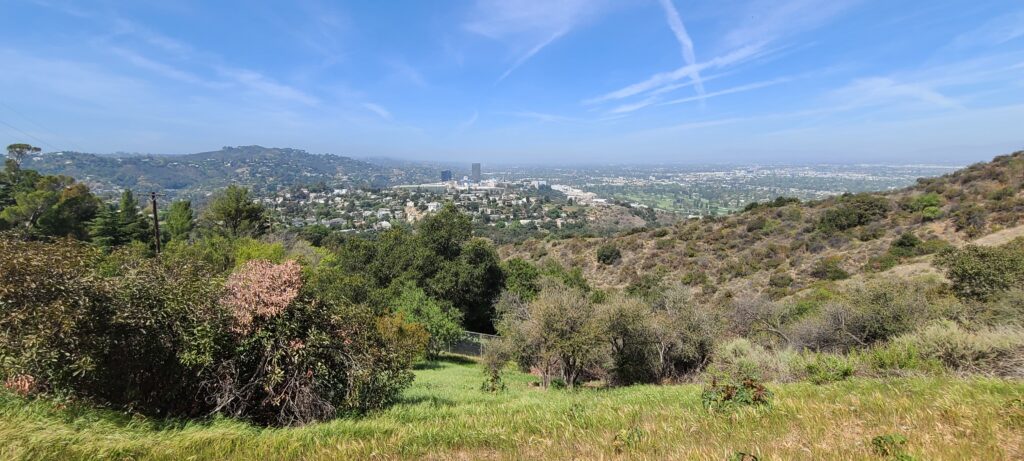
To get to the Mount Hollywood summit, Griffith’s highest peak, pick up the trail at the north side of the Observatory parking lot. Starting off amid scrubby evergreens, the path quickly emerges into the hills, winding higher and deeper, with the Hollywood Sign appearing to the left about 15 minutes in. After about a solid 40 minutes of walking, you’ll reach the top: a big, dusty clearing with picnic tables. It’s an ideal vantage point for checking out sweeping views of the Los Angeles basin, the edge of the San Fernando Valley, the hazy hills to the west, the skyline of Downtown Los Angeles with the Observatory in the foreground, and a close-up of the Hollywood Sign at eye level.
- Address: 2800 E Observatory Ave
- Hours: 5am–10:30pm. Hiking trails close at sunset.
- Parking: lot next to the Griffith Observatory or street parking along Observatory Avenue. Both cost $8–$10 per hour. Alternatively, a DASH bus runs up Vermont Avenue daily from 10am–10pm for only 50 cents (35 cents with a TAP card).
- Pets: Dogs allowed on leashes.
- Length: 3 miles
- Time: 90 mins
2. Runyon Canyon (Hollywood)
You can catch the loop from the east (Fuller Avenue) or west (North Vista Street) side of the canyon. Either way, it’s a mostly gradual ascent, except for a treacherously steep and narrow section near the top of the eastern canyon wall. At the top, the trail plateaus along a ridge, giving views of the architectural hodgepodge of the Hollywood Hills, downtown Hollywood, the Capitol Records building, and the tangle of high-rises along Miracle Mile. You can also take a shorter hike from Mulholland Drive.
- Address: 2001 N Fuller Ave
- Hours: Dawn to dusk
- Parking: Street parking. Franklin Avenue is a good place to find a two-hour spot. You can enter the park on North Fuller Avenue or North Vista Street. Watch out for permit-parking only blocks in this neighborhood.
- Pets: Dogs are welcome with much of the trail allowing off-leash roaming.
- Length: 1.5 miles with possibilities to extend
- Time: 30–60 mins
3. The Sara Wan Trailhead at Corral Canyon (Malibu)
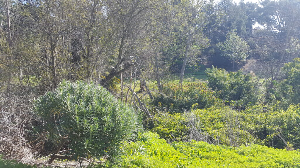
Where mountains collide with ocean, it’s hard to go wrong in the search for perfect views. What makes Malibu’s Corral Canyon stand out is its raw nature: coastal sage scrub and willows clinging to parched hills (lush with wildflowers after a wet winter), plus the occasional bunny or lizard. It’s a fairly gentle and deserted (on a weekday afternoon) hike. Hang a left at the first fork, this way you can face the ocean during your descent. Cutting through wild fennel and rust-colored grasses, the packed dirt path leads you on switchbacks along the east side and top of Corral Canyon. The descent toward the ocean has views of Santa Monica beaches all the way to Point Dume.
- Address: 25623 Pacific Coast Hwy, Malibu
- Hours: Dawn to dusk
- Parking: Plenty on PCH by Malibu Seafood; or pay $8 (cash or check) in the lot at the trailhead, just east of the restaurant.
- Pets: Dogs allowed on leashes.
- Length: 2.5 miles
- Time: 60–90 mins
4. Baldwin Hills Scenic Overlook (Culver City)
If it’s your first time, don’t look back until you reach the top. That way you’ll maximize the surprise of this north-gazing view of L.A.’s east-to-west spine, far less photographed than the south-facing Hollywood Hills, but just as worthy. Peer east toward Downtown’s skyline and the sprawl of South L.A. To the north and west, Century City high-rises and Westwood’s Mormon temple cut imposing figures, with the Santa Monica Mountains serving as a smoky backdrop. The hill’s central location and low-key crowd make you feel like you’re above the city, and within it, all at the same time.
- Address: 6300 Hetzler Rd, Culver City
- Hours: 8am to dusk. The visitor center is open occasionally, usually Thursday to Saturday mornings.
- Parking: Look for parking on Jefferson Boulevard or drive to the top and pay $2 per hour or $6 per day.
- Pets: No dogs allowed.
- Length: Less than 1 mile, but very steep
- Time: 30 mins
5. Echo Mountain (Altadena)
“A quiet refuge from people and wild life forever,” declares a sign at the entrance to the Sam Merrill Trail. The hike begins by scaling the wall of a canyon and emerging onto the face of the mountain about 15 minutes later. The views of Downtown L.A., Pasadena and the San Gabriel Valley are stellar even at low levels. But once you get to the top, there’s the added bonus of a fascinating L.A. history: In 1894, ambitious industrialists linked this mountaintop to nearby Pasadena with a train and then established an alpine resort, unofficially dubbed the White City, complete with a 70-room mansion. Two fires burned everything to the ground within a decade of its opening. All that’s left now are ruined foundations and train tracks for hikers to explore and picnic on. It’s a poetic view of the charred remains of a long-lost dream.
- Address: E Loma Alta Dr at Lake Ave, Altadena
- Hours: Part of the Angeles National Forest, the trail doesn’t officially close and is popular with night hikers.
- Parking: Look for free street parking by the entrance.
- Pets: Dogs allowed on leashes.
- Length: 5 miles
- Time: 2.5–3.5 hrs
6. Portuguese Bend Reserve (Rancho Palos Verdes)
Portuguese Bend Reserve is a maze of trails across a 399-acre park. To start, from the street head into the park down Burma Road, where you will follow it past Dr. Ibrahim El-Hefni Vista Point. Turn left on Eagle’s Nest Trail, which you will follow for about nearly two miles until you meet back up with Burma Road. You can either head back up here or continue onto the lower loop by taking a right down Toyon Trail. Keep left until you reach the end of Toyon Trail, when you will take a right on Peppertree Trail. Continue on this trail until you quite literally hit a fence, and then head left up Klondike Canyon Trail. You’ll hit a fork in the trail and can take either trail but keep left for the easiest one. Head left up Barn Owl Trail until you hit Burma Road, where you will turn left. This will lead you to the closing of the lower loop. Once you meet back up with Toyon Trail, rather than going back where you came from, head right on Ishibashi Trail which will once again lead you to Burma Road, where you’ll turn right and follow it back up to the trail head.
- Address: Crenshaw Blvd and Burrell Ln, Rancho Palos Verdes
- Hours: Dawn to dusk.
- Parking: Look for free street parking by the entrance .
- Pets: Dogs and horses allowed.
- Length: 5.15 miles (a shorter, 3-mile hike is possible by omitting lower loop).
- Time: 2.5–3.5 hrs