
March 6, 2023
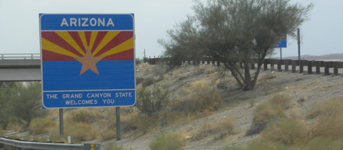
United States – Arizona. Part 1 – history and facts
There is no consensus as to the origin of the name “Arizona”. “Ali shonak” or “Ari-son” in the Pima Indian language means “Little spring”, as does the word “Aleh-zone” in the Tohono O´odham language. The Spanish Indian “Ali Shonak” wrote “Arizonac” and – apparently – it stayed that way, with the difference that with time began to omit the letter “c” at the end. Some linguists believe that the name of the state may come from the Spanish phrase “árida zona” – barren area – or from the Basque phrase “aritz she” which means “good oak”. The latter origin of the name Arizona seems unlikely, although Basques were present among the conquistadors and the Franciscans. So it is assumed – in principle – that Arizona is a twisted Spanish word derived from the Pima Indians or the Tohono O´odham Indians. Although the Spaniards used this name long before the Americans came here, in America the name “Arizona” was first officially used only in the Secession Declaration of the United States Confederation in March 1861, enumerating the areas included in the newly formed state.
Areas of what is now Arizona and the entire southwest were inhabited long before the white man came here. Waves of secondary migration, from South America and Mexico today back to the north, took place more than 25,000 BC. Many tribes lived here, both sedentary, such as Anasazi and Ute, and nomadic, about which science today knows almost nothing. It is known, however, that the Navajo and Apache tribes began to arrive in this area in the 13th century, and the oldest structures in the rock crevices – cliff dwellings – date back to the 11th century.

According to an old Spanish legend, the seven bishops who managed to flee Spain during the Moorish invasion founded seven Christian cities somewhere in a distant mainland. In 1527, a native testified that there were seven immensely wealthy cities called “Cibola” north of Mexico, making the old tale of the golden cities founded by seven bishops suddenly revive. No wonder then that in 1539 Mexico’s viceroy Antonio de Mendoza commissioned a Franciscan missionary, Marcos de Niza, to investigate widespread rumors of mysterious cities. From the town of Yacapa, Marcos de Niza first sent Esteban’s Moroccan servant along with some men to seek out the towns. He was to communicate with de Niza through a messenger who would have the cross with him in case of good news. The size of the cross was to signal the importance of this message. Esteban sent a very large cross via a messenger and vanished without a trace. After some time, only one of the members of the expedition returned, bringing the news that one of the cities of “Ciboli” had been found. The remaining members of the expedition were killed by the Zuni Indians.
According to another version, Esteban and Alvar Núñez Cabeza de Vaca were the only survivors of a completely different expedition – the unsuccessful Florida expedition of Pánfilo de Narváez, the survivors of which found themselves in today’s Texas, Colorado and Arizona in a few years’ journey. Esteban’s fantastic stories ignited the imaginations of the Spaniards so much that soon they organized at least two trips to the north: the aforementioned Marcos de Niza expedition (Niza is Nice in Spanish, a city in today’s France, at the time of Marcos de Niza’s birth it was in the hands of the Italian Savoy family) and a year later a great expedition led by Francisco Vasquez de Coronado – both in search of the great riches of Cibola. Marcos de Niza himself brought even more fantastic news about the cities of Ciboli. He claimed to be simply magnificent, even bigger than Mexico City, and he described one of them in detail. According to him, it was the smallest, but it had beautiful, large houses with large terraces and was built of stone. He also said that he had seen large amounts of precious emeralds, and that the amounts of gold and silver were greater than anything found in Peru so far. Nobody knows how these fairy tales were born in Marcos’s head. What he could really see was an Indian village made of stone and silt, and what he thought was gold and silver might be sandstone glistening in the sun. However, no one questioned Marcos’ revelations and everyone believed that he had found and indeed saw the legendary “seven golden cities”.
After the expedition of Francisco Vásquez de Coronado, who explored Arizona, Colorado, large stretches of Utah and Kansas, no one else appeared in these areas for the next 40 years (García López de Cárdenas, a participant in the Coronado expedition, was the first white man to see the Grand Canyon ). The spectacular failure of the Coronado expedition made the cities of Cibola forgotten for good, and anyone who dreamed any more of the legendary riches somewhere in the Indian land in the north was ridiculed. The first great deposits of silver in New Spain – as the Spanish territories of North America were called – were unexpectedly discovered first in 1546 in the province of Zacatecas, where the city of Durango was later founded, and then in 1567 in Chihuahua – the most northern part of today’s Mexico, near Mexican the city of Santa Barbara, right on the border with the state of Durango. At that time, also abandoned hopes of finding precious metals far to the north, despite the failure of Vasquez de Coronado’s expedition, were revived. The excitement soared that in 1581 a new expedition was organized under the command of Augustine Rodrigez and Captain Francisco “Chamuscado” Sanchez, which set off from Mexico City following Vasquez de Coronado’s expedition along the Rio Grande River (Rio Bravo) to his former winter camp.
The expedition paved the way, later called “El Camino Real” (The Royal Way), through which cotton products made by the Pueblo Indians were transported to Mexico and goods from the south to Santa Fe and other settlements and missions in the United States today. The members of the expedition were also the first to travel the so-called The “Jornada del Muerto” (Death Route), leading through a 90-mile desert area where the first atomic bomb exploded almost 300 years later. After a fruitless search for precious metals, the expedition returned to Mexico, leaving three missionaries in the Indian village.
A year later, Antonio de Espejo and Bernardino Beltran set off with another expedition in search of gold. In his later report, Antonio de Espejo claimed to have found “promising looking rocks”. His report, however, became known for a completely different reason. It was he who first used the name “Nuevo Mexico” (New Mexico) to describe these areas, despite the existing names “La Tierra Nueva” (New Earth) and “Cibola”. When the governor of Mexico began using this name in 1562, it was accepted and entered into common use, and has survived to this day. Interestingly, the name New Mexico suggested to many enthusiasts that the land was as rich in silver and gold as Mexico in the south, which was named after the main Aztec tribe – Mexica. Over the next years, the area of New Mexico (today’s New Mexico and Arizona) was almost completely forgotten by the Spaniards, and only sporadically small groups went here in search of precious metals.
In 1588, Spain suffered the worst defeat that could befall a power whose power was based mainly on the navy. The Great Spanish Armada was routed by the English fleet during Philip II’s unsuccessful invasion of the islands. The main reason for the defeat was not the martial arts of Elizabeth I and her generals, but the wrong decisions of the Spaniards and a sudden storm. After several previous attempts to land the English on the Iberian Peninsula and the Spaniards on the island, 66 English ships were suddenly taken by surprise by the entire Spanish Armada while being loaded at the port of Plymouth on the English Channel. The Spanish admiral, Duke of Medina-Sidonia, Alonso Pérez de Guzmán decided to pursue a scattered English fleet, which dragged the Spaniards deep into the Canal. Instead of turning back, the admiral decided to wait for reinforcements and ordered anchors to be dropped off Calais, giving the English time to gather their strength and close the way back. The English inflicted heavy losses on the Spanish fleet in the naval battle of Gravelines near Calais, but failed to sink a single Spanish ship. Sailing around Scotland and Ireland, the Spaniards lost 54 ships in sudden storms and unfavorable winds. The Great Armada was not actually smashed, as depicted in the paintings of the English period painters, but decimated by Poseidon, and for the next 15 years the specter of the Spanish invasion still hung over England. Tied up in a permanent conflict and trying to stabilize the situation in the rebellious Netherlands, Spain lost the ability to defend and control its own overseas properties for many years.
If the Grand Armada had landed at Tilbury, where an invasion was expected, instead of docking at Calais, the frail English troops would have been defeated in a matter of days. It would be useless to inspect the army on a white horse, or to make passionate speeches to the soldiers of the “virgin queen”. The history of the world would have probably turned out quite differently.
Philip II died in 1598 (having previously borrowed a large sum from Queen Bona Sforza and allegedly commissioned her to poison her soon so that she would never return the money she had borrowed) and New Spain could no longer count on any help from the country. So it was decided to act independently, and soon a detachment was created under the command of Juan de Oñate, the son of a wealthy miner from Zacatecas, who organized a number of successful expeditions, during which he twice reached the Gulf of California, then called the Sea of Cortez. Many of the participants of his expeditions had Spanish-Indian roots, and in the veins of Juan de Oñate’s wife the blood of both the Spanish conquistador Cortez and the Aztec emperor Montezuma flowed (the name of the Aztec leader was Motecuzoma, and the highest position in the state was called “Uey Tlatoani” – “Reverend Orator “Uey Tlatoani” is a parliamentary function, similar to that of Speaker of the Seym or Senate Consul in Republican Rome.)

One of the most famous missionaries in the present state of Arizona was a Jesuit Father Eusebio Francisco Kino. While still a very young man, he received a professorship at the University of Ingolstadt in Germany. Before taking the job, however, he had become so seriously ill that he almost lost his life. Praying to Saint Francis Xavier, he promised that when his life was saved, he would enter the Jesuit order to serve God. And so it happened, he managed to recover, and as a token of gratitude, he took the name of his patron saint, Francis, and entered the convent. After graduating from the seminary, he asked to be sent on a mission to the Middle East, but in 1681 he was sent to New Spain, as the territory of present-day Mexico was then called, Mexico City. He was then sent to the province of Sonora in the northwest of Mexico, where Francisco Kino set up a mission in 1687. He arrived in present-day Arizona in 1691 and founded three new missions there: San Cayetano Tumacacori, more to the north of San Xavier del Bac, and Los Santos Angeles de Guevavi. The Mission of San Xavier del Bac is the only one that continues to function today and is the pride of Tucson. In addition to his missionary activities, Father Kino taught the Indians various methods of cultivating the land and brought horses, sheep and mules to Arizona. His activities laid the foundations for the development of a new economy based on agriculture in Santa Cruz and the San Pedro Valley.
Kino’s father was also an explorer and cartographer. He made many journeys north, as far as the Gila River, and two journeys to the Colorado River. He has penetrated the Gulf of California and proved that the land visible from the bay is in fact a peninsula and not an island as previously thought. He immortalized it on a map published in 1710, which for the next 100 years was a model for other cartographers. Kino’s father has traveled nearly 70,000 miles in his lifetime. He was a tireless wanderer who, at the age of 55, could cover 40 miles a day for 26 consecutive days. He died in 1711 in the town of Magdalena in Sonora.
After independence from Spain, the new Mexican Republic took over all the provinces previously belonging to New Spain and incorporated the territory of today’s Arizona into the territory of Nueva California. During the American-Mexican War of 1847, the Americans occupied almost half of Mexico and even occupied Mexico City, which became an important part of the peace negotiations. The peace treaty ending the war, signed on February 2, 1848 in Guadalupe Hidalgo, approved the status quo, formally handing over to the Americans the territory annexed during the war, and which later allowed the creation of the states of California, Nevada and Utah, and the new New Mexico Territory, including the present-day states of New Mexico and Arizona.
More than half of today’s Colorado and the southern strip of Wyoming are the rest of the areas previously annexed by the Guadelupe Hidalgo treaty. The Mexican government also recognized the annexation of Texas in December 1845 (Texas formally left Mexico and declared independence on March 2, 1836), and the purchase in 1854 of disputed land along the entire border with Mexico, including Tucson, Yuma and Las Cruces in New Mexico (Gadsen Purchase), deprived Mexico of half of its territory, increasing the territory of the United States by a third. The ease with which the Mexican government agreed to lose such a large part of the country’s territory in 1848 might have been surprising if not for the aforementioned fact that the Americans occupied half of the country, including the capital, which clearly influenced the content of the peace treaty. Named “Treaty of Peace, Friendship, Limits and Settlement between the United States of America and the Mexican Republic”, it was signed in a small settlement a few miles from Mexico City, when the American occupation forces were stationed there. The US takeover of northern Mexico, forced by war and capitulation, was partially covered up by a land sale agreement in which Mexico sold almost half of its territory to the United States for $ 15 million in installments of 3 million a year (plus the repayment of $ 3.25 million in Mexican government bonds). in the areas taken over by the USA).

The great territory of New Mexico existed until its southern part (half) seceded from the Union in March 1861 and joined the Confederation on the eve of the Civil War. This part, by the resolution of the Civil Convention of March 16, 1861 and ratified in Tucson on March 28 of the same year, recognized itself as part of the Confederation with its capital at Mesilla and adopted the name of the Confederate Territory of Arizona. Confederate Arizona was officially declared CSA territory by a special proclamation by Confederate President Jefferson Davies on February 14, 1862. The Davies Proclamation was the first official document to use the name “Arizona”. Confederate Arizona existed formally until the South surrender on April 9, 1865, but state authorities were evacuated to El Paso, and later to San Antonio, Texas, in July 1862 under pressure from EU troops. Confederate territory was controlled by EU troops long before the war ended in ’65. The US Confederation has never been formally recognized as an independent state, not only by the Union but by most of the world.
Long before the end of the Civil War and a month after the proclamation of Jefferson Davies, in March 1862, the House of Representatives of the US Congress (Union) passed a resolution according to which the territory of New Mexico, within the boundaries before the unrecognized secession from the Union and the accession of half of it to the Confederation, was divided in two along the north-south line. The western part was called Arizona Territory and the eastern part was called New Mexico Territory. On February 24, 1863, President Abraham Lincoln signed an act that created the so-called “Arizona Territory” with the New Mexico border along Meridian 107, still in use today. The southern half of both territories were still within the Confederation, so the capital of the Arizona Territory was located far north of the Confederate border, near the mine in the Chino Valley, and was named Prescott, after the historian who described the events taking place in these areas. The resolution of the House of Representatives did not fully enter into force until after the Civil War. On February 14, 1912, the 50th anniversary of President Jefferson Davies’ proclamation declaring Arizona a Confederate territory, and as a memento of this event, the official date of Arizona Territory status as a state was recognized. This day is an official state holiday.
In 1910, the United States Congress passed a law allowing Arizona delegates to formulate their own constitution. The new constitution created a bicameral legislative body elected every two years, the post of governor whose term also lasted two years, and general election of judges who could be dismissed. On February 9, 1911, the constitution was approved by an overwhelming majority of Arizona citizens’ votes. In August of the same year, the US Congress passed a resolution giving Arizona and New Mexico the status of states. The resolution was opposed by President William Howard Taft, who was against the possibility of dismissing judges in Arizona. President Taft has made it a condition: Arizona will become a state if the constitutional retraction of judges is withdrawn. On December 12, 1911, voters agreed to this condition, and on February 14, 1912, Arizona became the 48th and last continental state in the Union. The granting of state status to Arizona completed the process of forming a state administration in the United States. And here is one more interesting fact: shortly after the ceremony of obtaining the status of state, which was filmed, the Arizona authorities, with the support of voters, reinstated the provision on the possibility of dismissing judges in their constitution, thus demonstrating their independence from the central government in Washington.
During World War I, more than 12,000 people from Arizona served in the US military – more than any other state. Two residents of the state received the prestigious “Congressional Medal of Honor”: posthumously John Henry Pruit, who personally captured 40 German soldiers, and the pilot, Lieutenant Frank Luke, who shot down 14 observation balloons and 4 German planes in just ten combat missions (attacks for balloons were very dangerous, as they were especially guarded by fighter planes and anti-aircraft artillery).
Navajo ciphers played an important role during the Second World War. They were called “Wind-Talkers” or “Code Talkers”. They participated in battles with the Japanese in the Pacific. Japanese cipher experts never managed to break the American Navajo cipher. It never occurred to anyone that the cipher was the language of the Navajo Indians. If linguistic rules were used, the code would be cracked very quickly. During the Arizona War, there were POW camps for captured German and Italian soldiers. Within what is now Phoenix, there was also the infamous internment camp for Japanese Americans who were massively displaced from San Francisco and elsewhere and illegally held in camps until the end of the war.

The Second World War contributed to the economic development of the state in which companies producing for the army began to establish their headquarters. The population in larger cities began to grow rapidly. Along with the application invented by A.J. Eddy air coolers, companies that reported losses during the hot summer, started making profits due to improved working conditions for employees. In the 1960s, Arizona became the new home for thousands of retirees fleeing to warm lands from the harsh winters of the North and East Coast. Arizona today is a very modern state, but still appreciates old southern traditions that are visible throughout the state.